


New article
Recently updated
Viewing properties of map objects

Who is this article for?Noise analysts who need details of runways, gates, complaints or RMTs shown on the map.
Access to the ANOMS Noise Analyst Workbench is required.
You can display additional information about various map objects — such as runway ends, gates, corridors, complaints, and NMT locations — directly from the map.
Displaying runway end properties
This example demonstrates how to view properties using a runway end.
To display runway end properties:
- Right-click a map object (for example, a runway end).
- Select Runway Properties from the menu.
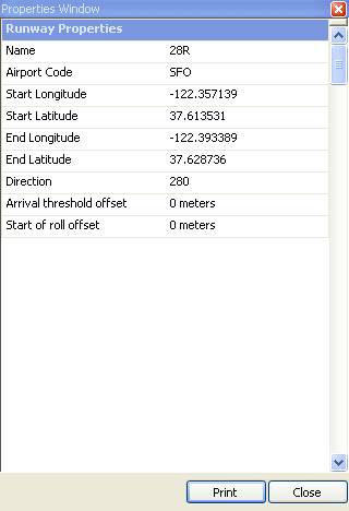
The Runway Properties window displays the runway name, airport code, coordinates, and offsets.
Viewing properties of other map objects
The same right-click approach works for other common map objects, including gates, corridors, complaints, and NMT locations.
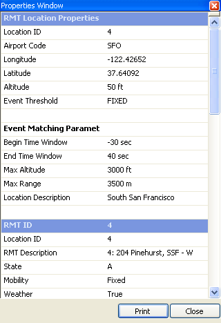
An RMT Location Properties window, showing the location, event threshold, and event matching parameters
Note: You can also use Map Tags to display information on the map (see "Using Map Tags to display flight track details").