


New article
Recently updated
Using the Map Browser overview and commands reference

Who is this article for?Noise analysts who want to understand the Map Browser and its commands.
Access to the ANOMS Noise Analyst Workbench is required.
The Map Browser is the geographic heart of ANOMS, displaying flight tracks, noise data, complaints, and query results on a single map window.
Understanding the Map Browser
ANOMS displays only one map window at any time. Other ANOMS windows and functions send their output and query results to this same map window. For example, flight tracks loaded into Replay display in this map window, as do tracks loaded into the Operations Browser.
Features of the map display include:
- 2D and 3D viewing of flight tracks, noise levels, complaint areas, streets, and geographic information
- Point-and-click access to information about flight tracks, streets, and other layers, plus zoom in, zoom out, pan, rotate, and PCA
- User-saved views
Note: Available layers and features vary by site configuration.
Opening the Map Browser
To open the Map Browser:
- On the main toolbar, click the Map Browser button.
The Map Browser window appears.
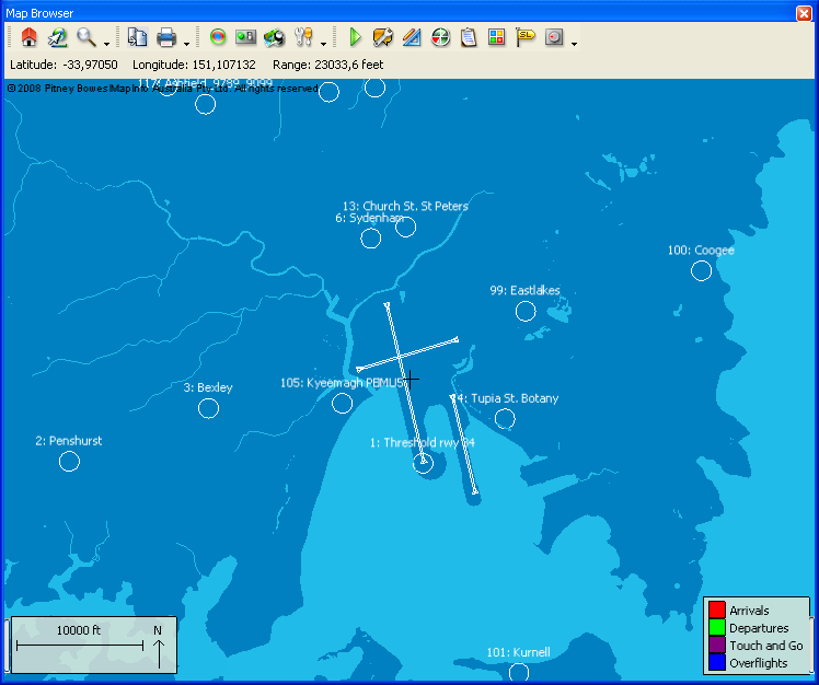
The Map Browser window, showing RMT locations, runways, and the track colour legend
Using Map Browser commands
Commands for working with the Map Browser can be selected directly from the Map pull-down menu, or by clicking the corresponding toolbar buttons.
Command | Definition |
Copy | Copies the map to the clipboard |
Prints the map to networked printers or to a file | |
Reset | Resets the map view |
2D/3D | Toggles between 2D and 3D views |
Transform Map | Precise use of the map controls — pan, zoom, and rotate — with entry of longitude and latitude |
Contour | Controls the noise contours displayed on the map |
Track Filter | Removes flight tracks on the map that did not enter a certain area |
Track Time Filter | Filters mapped flights so only a certain time section is displayed |
Feature Manager | Controls the layers and objects displayed on the map: map images, roads, gates, NMTs, and so on. Also controls the point of origin, gridlines and range circles, and the default distance unit |
Map View | Saves and loads stored map views |
Properties | Displays operations details for the selected flight |
Replay | Replays flights on the map |
Map Tags | Adds tags to display flight track details on the map |
PCA | Point of Closest Approach |
PGA | Penetration Gate Analysis |
Annotations | Adds user text to the map display |
Map Colours | Controls the map colours |
Street Finder | Locates and displays a street on the map |
Display Targets | Displays targets for a selected flight |